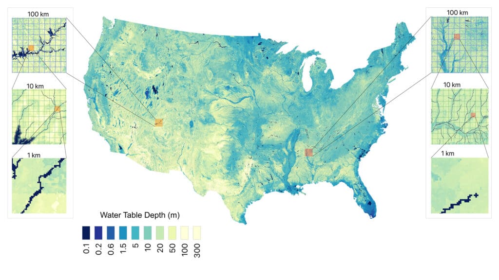
Combining direct measurements with artificial intelligence methods, researchers at Princeton and the University of Arizona have created a map that estimates groundwater depth across the continental United States at a resolution of around 30 meters (98 feet).
Copy and paste this URL into your WordPress site to embed